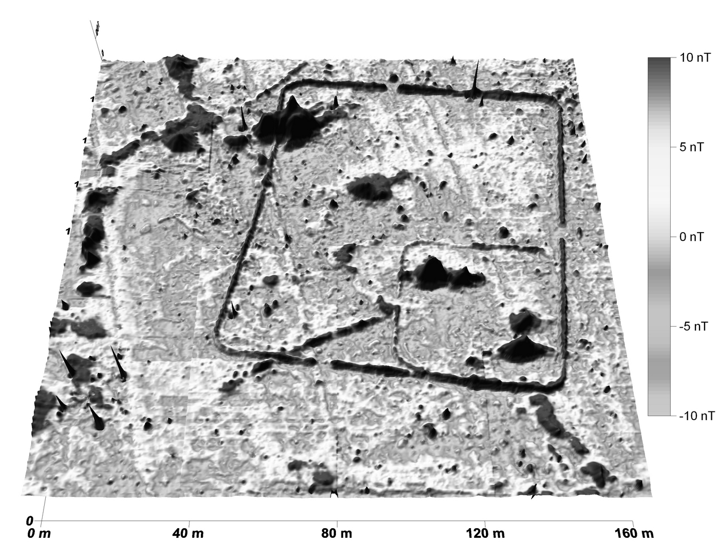
Fig. 9. Burgsalach, Bavaria. The magnetometer image processed
as a pseudo 3D-image of a Roman camp revealed very clearly two archaeological
phases of the fortification. Magnetometer survey with Smartmag SM4G-Special caesium-magnetometer,
sensitivity ± 10 Picotesla, variometer (duo-sensor) configuration, 40 ×
40 m grid, spatial resolution 12.5 ×
50 cm, interpolated to 25 ×
25 cm, intensity of total Earth's magnetic field at the site: 48.220 ± 20 nT ,
date 4/2008, angle of dip +65°, grey shade plot in 256 greyscales from positive
(black) to white (negative)